
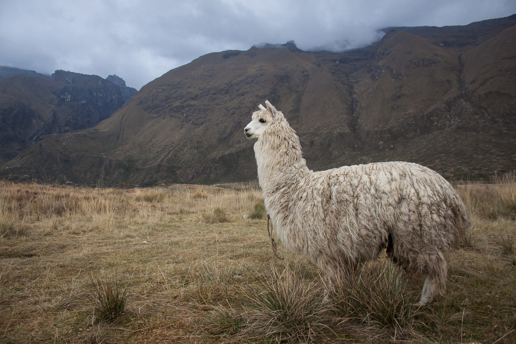
Peru is a land of wonders – natural, cultural, and historical. We spent a month exploring this fantastic and huge country, marveling at the colorful desert landscapes, wide-open beaches with perfect rolling waves, snowcapped peaks, herds of llamas, alpacas, and vicuñas, ancient ruins, and bustling municipal markets filled with myriad colors and scents. We roamed back and forth between the beach and the mountains – surfing great little breaks and free camping with a herd of other VW vans one week, and the next climbing in one of the most spectacular regions we’ve ever seen high in the thin air of the Andes. We also spent a month battling crappy roads and the very aggressive Peruvian drivers, but that’s all part of the adventure, and Chimera continues to perform like a champ. Here is a selection of the hundreds of photos we took and many adventures we had in roughly the northern half of the country.

Paracas National Reserve.
Our first stop in the 11th country of our journey was in the small, touristy town of Mancora. Known for its consistent surf break, laid-back atmosphere, and party scene, Mancora is a common stop on the backpacker circuit. We avoided the crowds by parking at a great hostel high on a bluff overlooking the town and the waves. True to their reputation, the perfect waves curled around the small point all day long and, as expected, they were crowded, but Tim braved the throng early one morning and got in a great surf session.

Enjoying our first Peruvian beer on the beach in Mancora.

The view from our hilltop hostel, Mancora.
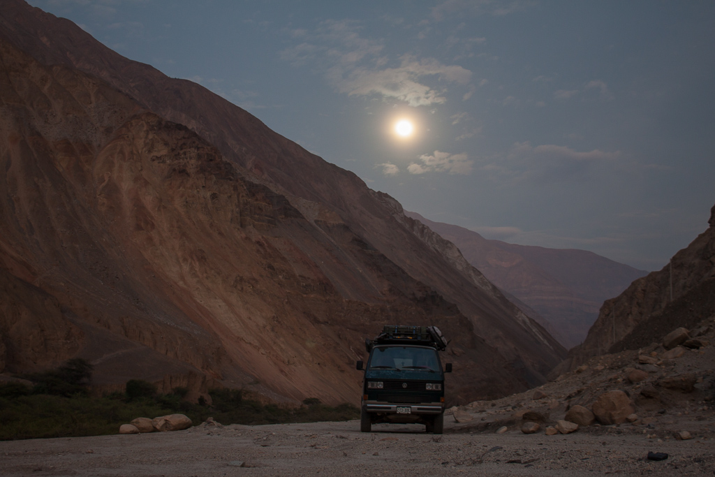
From the beach we headed inland toward the city of Cajamarca, which took us on some of the worst roads since our Baja California adventures. Giant potholes, landslides, rocks of all sizes littering the road, mud slumps, giant mud pits, washboards, half-finished construction with no obvious idea of which direction will go through and which will end in a dirt pile or an “excavacion profundo”, city streets that end in large drop-offs or stairs, bustling street markets narrowing traffic to barely one lane, narrow one-way streets with traffic going in both directions (including buses and large trucks, often leading to bumper to bumper confrontations and whole lines of traffic attempting to reverse), stream, sewer ditch, and runoff crossings, old rough cobblestone streets that rattle every bone in your body, and to top it all off the insane Peruvian drivers. Somehow we managed to get through it all unscathed. What an adventure!

Typical Peruvian road.

After a long day of driving we were treated to a spectacular sunset.

Street view, Cajamarca.

Mercado central, Cajamarca.

Mercado central, Cajamarca.
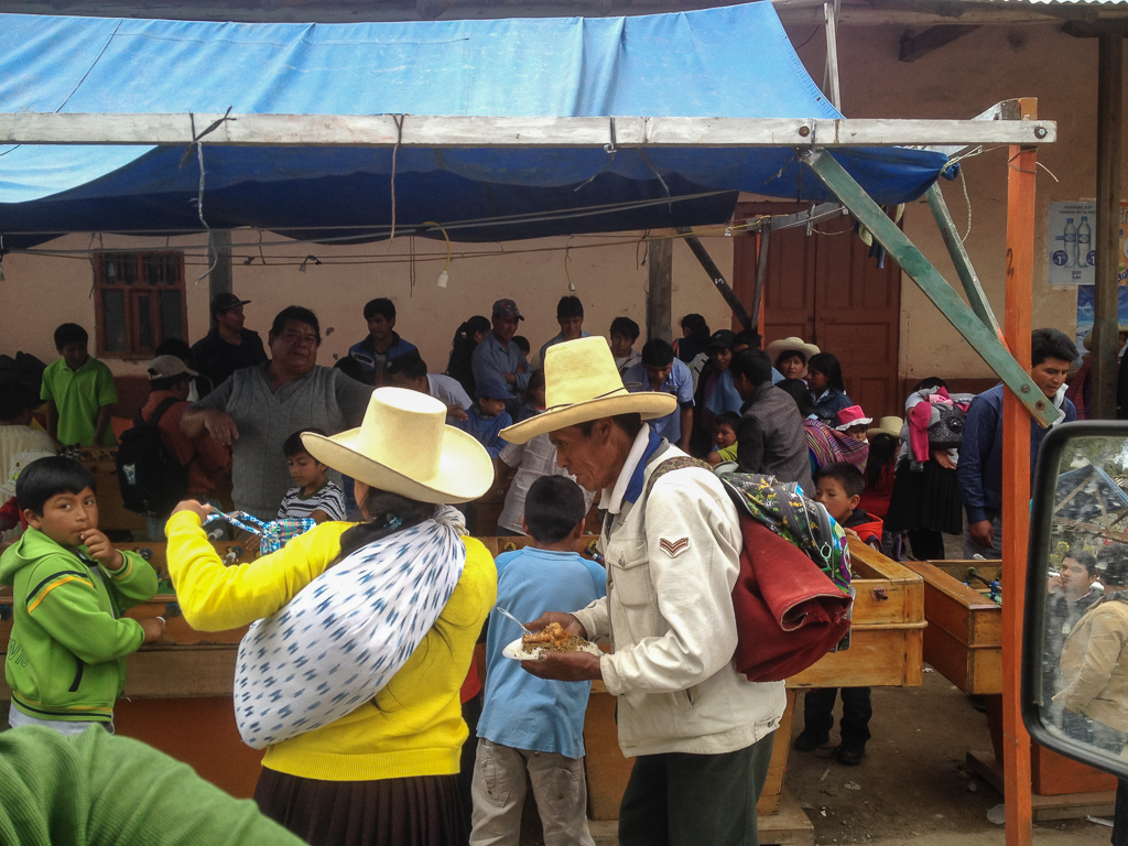
Checking out the awesome hats while we’re stuck driving through the middle of a busy street market.
One of the interesting sights near Cajamarca is the “ventanillas” or little windows. These ancient features are carved out of the sides of the cliffs in perfect little squares. Whether they were once used as some sort of burial chambers, or for other spiritual purposes is unknown, but they are preserved very well and decorate the hills. They also happen to be located in gorgeous countryside.
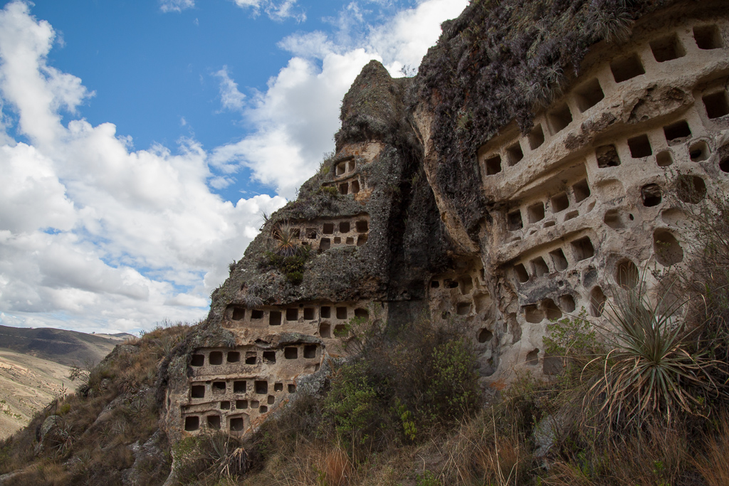
Las ventanillas.

Tim absorbing the vibes.
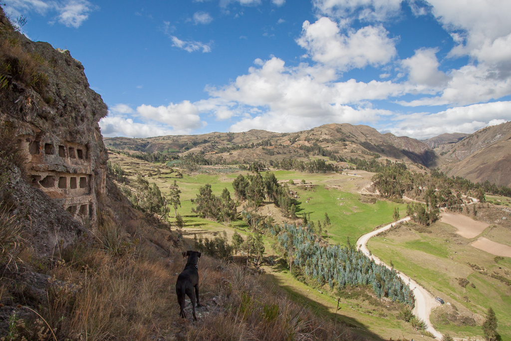
Hobie checking out the view from the ventanillas.
Heading back towards the coast we were looking for a spot to camp as dusk fell and came across a quarry. We pulled in and politely asked some workers if they would mind if we camped there for the night. They were very friendly and told us we were welcome and would be safe there. It turned out that this was a processing facility where they took large chunks of what looked like limestone and baked them for 12 hours in these large pits sunk into the ground. They then removed the product, crushed it up and shipped it off, we’re still not sure what it was. We were parked not far from the pits, which was a great source of heat on the cold night.

Cooking the rocks.

Fiery rock pit.
For the most part the main highways through Peru were in pretty decent shape, (sometimes we even got up to 100 kmp on the Pam-Am, whoa!), but the views on and along the roads never ceased to provide entertainment, terror, and awe. We were particularly intrigued by the endless political ads that decorated most walls, rocks, trees, poles, trucks, etc. We noticed that every candidate has his or her own symbol, often with the words “marca así” (“mark like this”) written next to it and an X mark. After seeing dozens of these we realized that maybe the ballots also have the symbols on them, making voting available to the illiterate. We never verified this theory, but throughout the entire country we continued to see these political symbols painted on every available surface.

One time when we were stopped by a traffic cop he tried to tell us that our surfboards stick out too far from the van. We almost laughed in his face, considering that this is a common sight on Peruvian highways.

Semis passing overlaoded semis with sugar cane stalks falling all over…typical highway driving in Peru.

Truck full ‘o guinea pigs off to the markets.

A selection of the many colorful political signs.
When we pulled into the little beach town of Huanchaco we were both quickly grinning from ear to ear. First we saw the huge open beach, then the perfect little waves rolling in by the pier, then we saw the other overlanders. We happened to hit Huanchaco at the same time as four other Volkswagons: two Vanagons, and two older buses. There was also a fun Austrian family in a larger camper. It turns out that in Huanchaco as the sun goes down the policemen kick everyone off the beach…except for the overlanders, who they just smile at and wave. That night the beach was decorated by a slew of happy campers, most of us in VW vans.
Besides its great little waves, which we both thoroughly enjoyed riding, Huanchaco is known for its traditional reed fishing boats, which the men still use every day. Examining these woven canoe-type boats on shore it’s hard to believe that they float, but on the water they glide over the waves with ease.

A fisherman with his traditional reed boat at sunset, Huanchaco.

Tim and Hobie posing with the reed boats.

Chimera posing with his new friends.

Beach boondocking with a flock of VW overlanders, Huanchaco.

Huanchaco panorama.
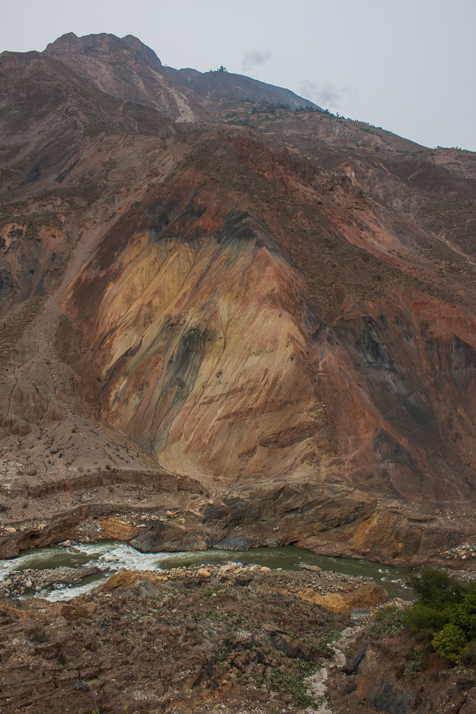
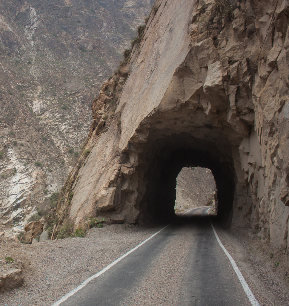
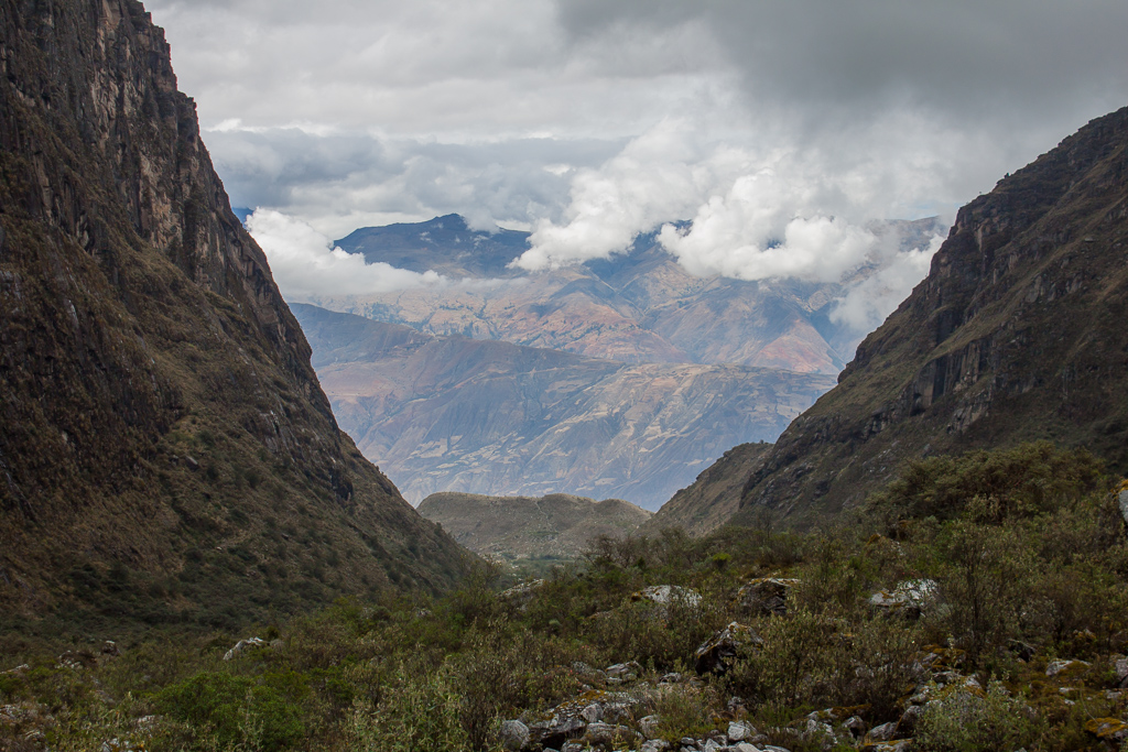
After we had our fill of the surf and van chat it was time to head for the big mountains – the Cordillera Blanca beckoned. The drive there involved venturing through the famed Cañon del Pato, a gorgeous, colorful river canyon with a narrow dirt road winding along its edge, passing through somewhere near 50 hand-carved tunnels. Needless to say, the drive was spectacular.
One of our countless beautiful roadside lunch spots.

Colors of Peru.
Lovely roadside camp spot with the full moon overhead.
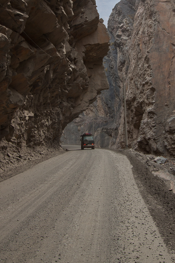
Entering the Cañon del Pato.

One of the 50 or so hand-cut single-lane tunnels along the Cañon del Pato.
Cañon del Pato.
Cañon del Pato.
Unfortunately when we arrived at the doorstep of the Cordillera Blanca we were not greeted by the stunning view of the soaring snowcapped peaks as so many visitors have been before, instead we saw a bunch of clouds. We knew that we were pushing the rainy season, but we’ve generally been pretty lucky with weather, so we were still planning on doing a three-day trek, assuming that we’d get some bad weather, but also lots of sun and great vistas. The weather gods had other ideas. After three days of camping out in a gorgeous spot on the doorstep of Huascaran, the highest peak in Peru, the clouds still hadn’t parted long enough to give us a view of the peaks. So we scrapped our trekking plans and moved on. Of course, as we drove away from Huaraz the mountains decided to tease us and the clouds parted long enough to let us know what we had been missing.
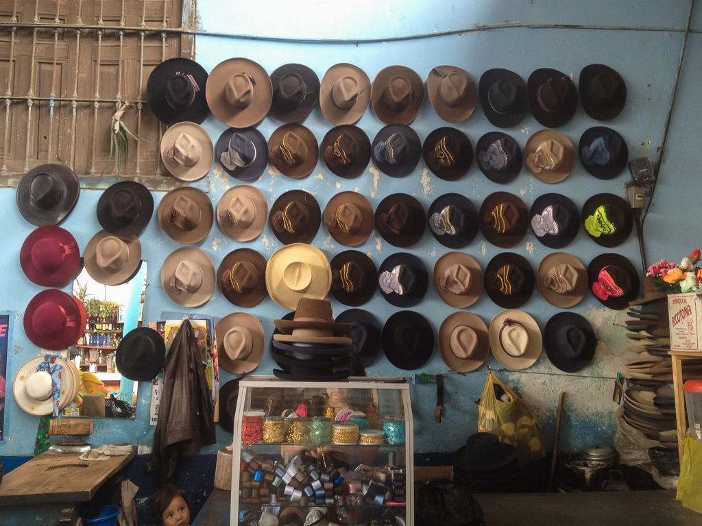
Hats for sale! Central market, Caraz.

Vicki and Nacho, two curious and friendly alpacas that hung out next to our campsite near Huascaran National Park.
Nacho posing for us on a break from chasing Hobie around.

Nacho the Snaggletooth.
The view from a great hike to an ice field at the toe of a glacier.
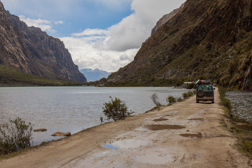
Huascaran National Park.

Glacial lake, Huascaran National Park.

One of the rare times the clouds parted enough for us to be able to glimpse some snowcapped peaks.

A glimpse back at the Cordillera Blanca.
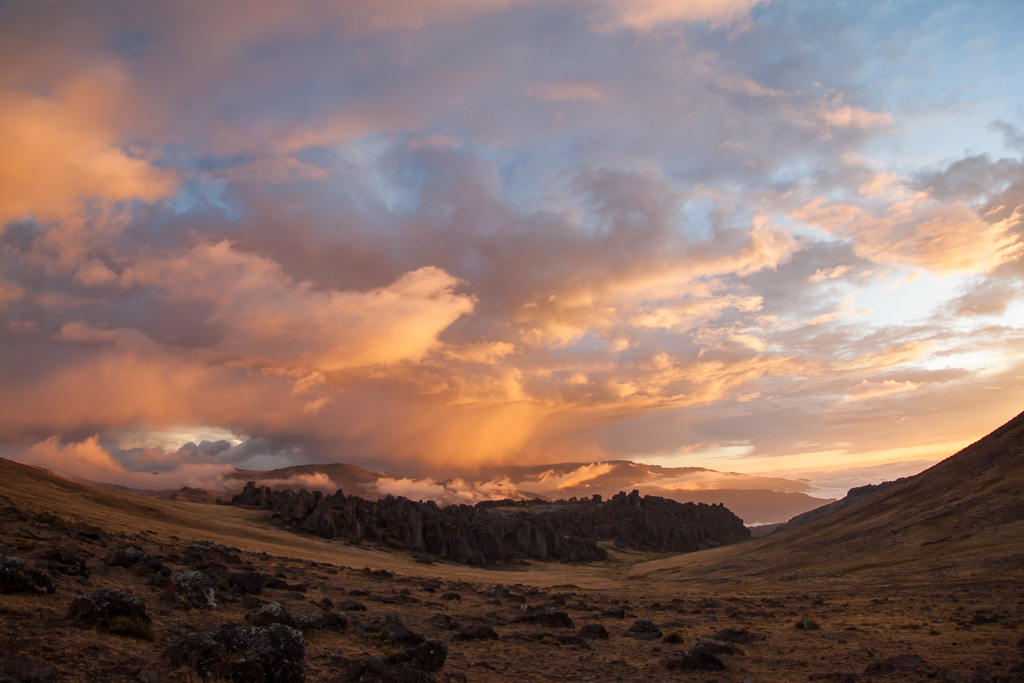
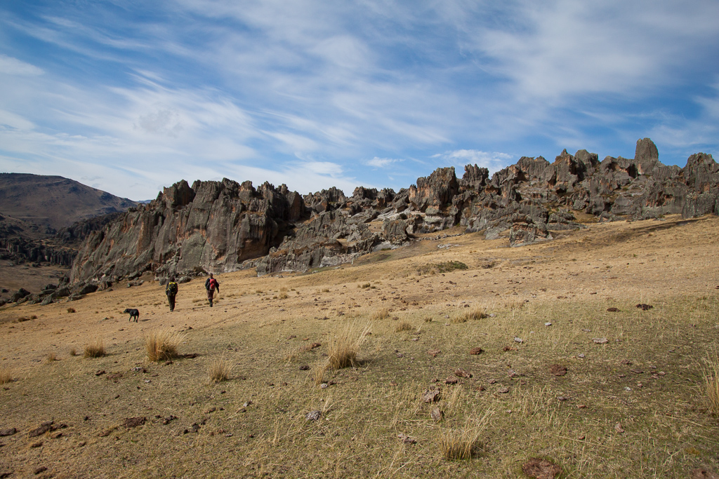
Our next destination was much anticipated – the rock forest of Hatun Machay. We turned off the highway onto a bumpy dirt road, shifted into four-wheel drive, and headed off into the fog. Somehow we managed to make the correct turns and found the rustic but comfy hostel of “El Refugio”, the only building in the whole area, with the exception of simple shepherd huts. When we arrived we could see nothing but a vague outline of the refuge through the mist. At around 4200m (13,780′), it’s often misty at Hatun Machay. That evening, however, the clouds cleared and we got our first view of the incredible rock forest backed by an amazing sunset. As we stood in awe of the beauty an archeologist staying at El Refugio called out to us “Welcome to Hatun Machay!”
We spent most of the next week hiking out to climb as soon as the sun warmed the rock enough for us to be able to feel our fingers, then retreating to the van or to the woodstove in the refuge as the afternoon mists rolled in. The climbing was spectacular. There are over 300 well-bolted routes at Hatun Machay and that still barely scratches the surface of the rock forest. In addition the scenery was gorgeous, replete with local shepherds guiding their flocks across the hillsides. It was hard to leave the rock forest, but as we pulled away with sore fingers we knew we’d be coming back some day.

The view from the drive up to Hatun Machay.

Our happy camp spot in the fog.
Welcome to Hatun Machay!

Hatun Machay panorama.

Our first morning heading out to the rock forest.

Emily and Hobie taking in the amazingness.
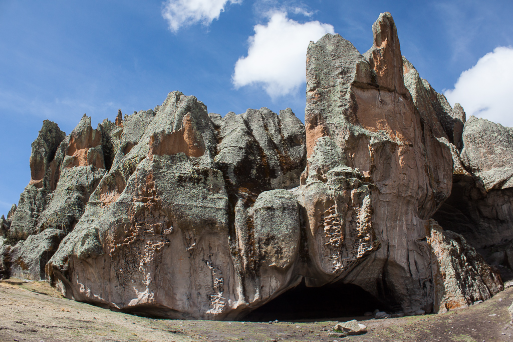
Such awesome rock – caves, huecos, jagged ridges, and great texture for climbing.

Emily cleaning a route in the afternoon fog.
Heading out on a another sunny morning with our new Canadian climbing friends Marty and JD.

Emily checking out a giant boulder.

One of the best routes we did, a great 5.10c with many huecos and a technical crux.

These mounds of fuzzy cacti dotted the hillsides.
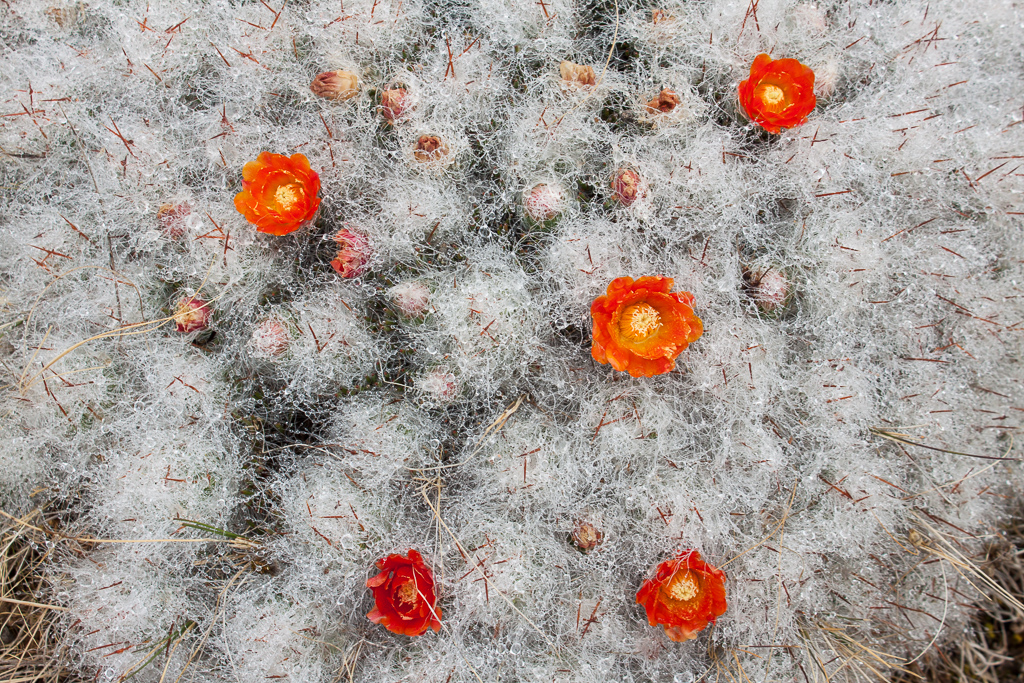
Fuzzy cactus blooms.

Tim rappelling in the mist.

Misty afternoon.
Having passed through Lima on various previous trips, we both dreaded the drive into the big city. As it turned out, however, it wasn’t all that bad, despite the completely un-controlled intersections with traffic flying through in both directions. Perhaps we managed to take the right roads at just the right time to avoid the infamous traffic snarls, or maybe we’ve just gotten hardened by all of the gnarly driving we’ve done through cities thus far in Latin America, either way we arrived at a great overlander-friendly hostel no worse for the wear. When we pulled in we were surprised to see familiar Colorado plates. Before long we were happily slobbered on by Kaleb, and exchanging war stories with Josh and Shannon. We spent the next few days as most other travelers do in Lima: eating our way through the countless excellent restaurants and bakeries, and walking along the well-manicured park lining the cliffs over the ocean, watching the paragliders above and surfers below. Somehow, possibly due to food coma or extreme sport envy, we neglected to take any photographs in the Peruvian capital city.

A great dune campsite on our way to Lima.

This estuary was filled with birds, which occasionally would all take off at one, filling the sky with wings.

Our first flamingo sighting, on Tim’s mom’s birthday.

Typical urban scene – one of the endless towns we passed through along the Pan-Am.

Roadside view.
A few hours south of Lima we managed to stumble upon yet another little beach town with consistent, gentle longboard waves. As soon as we pulled up along the malecon in Cerro Azul, Tim began drooling and it didn’t take long for him to hit the water. Over the next three days we both caught dozens of the long waves that curled around the rocky point and rolled all the way to shore. We met a great guy named Juan, a fellow surfer and 4×4 van (his is an awesome Delica) enthusiast, who offered to let us stay at his house right off the beach. When we weren’t surfing, cooking, or chilling with Juan, we hung out on the beach and shared beers with an entertaining local named Luciano at his jewelry booth. We dream about returning to Cerro Azul and riding more of those great waves.

Lovely little Cerro Azul.

Camped in the alleyway next to Juan’s house in Cerro Azul.
Tim waiting for the right wave, Cerro Azul.
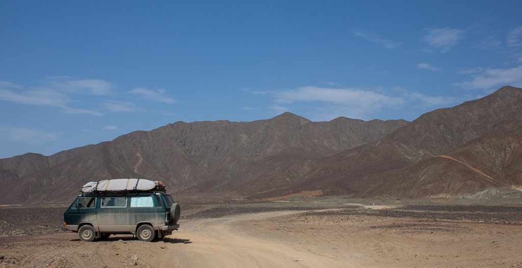
Further south along the Pam-Am we left the highway and headed out onto the giant dune-covered peninsula of Paracas National Reserve. From the entry gate the paved road soon turned to packed sand, and before long we were following only faint tracks across the sides of dunes out to one of the most grandiose campsites we’ve found yet. We felt very small and very lucky that night among the endless sand, stars, and waves.
We spent the next day slowing making our way down along the picturesque coastline of the reserve. Sometimes we were on well-marked roads, but more often we made our own way, usually following faint tracks. In some ways it reminded us of Baja, only on a grander scale, and without the amazing fish tacos.
Heading into Paracas National Reserve.

Desert road.

Spectacular camp site in Paracas National Reserve.
Paracas National Reserve.

Paracas National Reserve.
The road gradually disappeared and then we were just following faint tracks up steep dunes.
We knew that those spectacular views along the Paracas peninsula would be the last we would see of the ocean for quite a while, so we soaked up the deep blue vistas and salty air. That night we found ourselves parked on a side street in a tiny little oasis town. Huacachina is a true oasis – a palm fringed lagoon surrounded by tall rolling dunes.

We saw many of these semi-organized shanty towns dotting the desert. The walls and roofs of the small square shacks were made of woven reed mats.

Huacachina Oasis.
Saying our temporary goodbyes to sea and sand we turned east and began the long drive back towards the soaring peaks of the Andes.
Damn, maybe I should have met you guys in Peru!!
Still can’s believe the spectacular adventures you two are experiencing.
Keep it coming !!!
Very very cool! One of my favorite posts so far. Looks like some spectacular scenery.
Thank you so much for sharing your amazing photographs and journal. I feel like I’m there with you while I absorb your blog and I can’t wait to experience your next one!
Thanks for taking the time to share your adventures via photos and captivating stories. I know you are experiencing much more than you can share. I’m so glad for you both.
♥️♥️Godmom Abby